On this page
Closed consultation

Submit feedback to
Nicola
MacPhail
Carbonix
BVLOS operations below 1000ft AGL.
The issue
Operator Name: Carbonix
Operation Type: Geospatial LIDAR and Photogrammetry survey
Start Date: 01/04/2026
End Date: 01/04/2027
Days of Operation: Monday to Friday
Flight Times: 08:00 to 17:00 local time
Frequency: Averaging once every 2 months
Aircraft Type: VTOL RPAS with a 6-meter wingspan
MTOW: 80KG
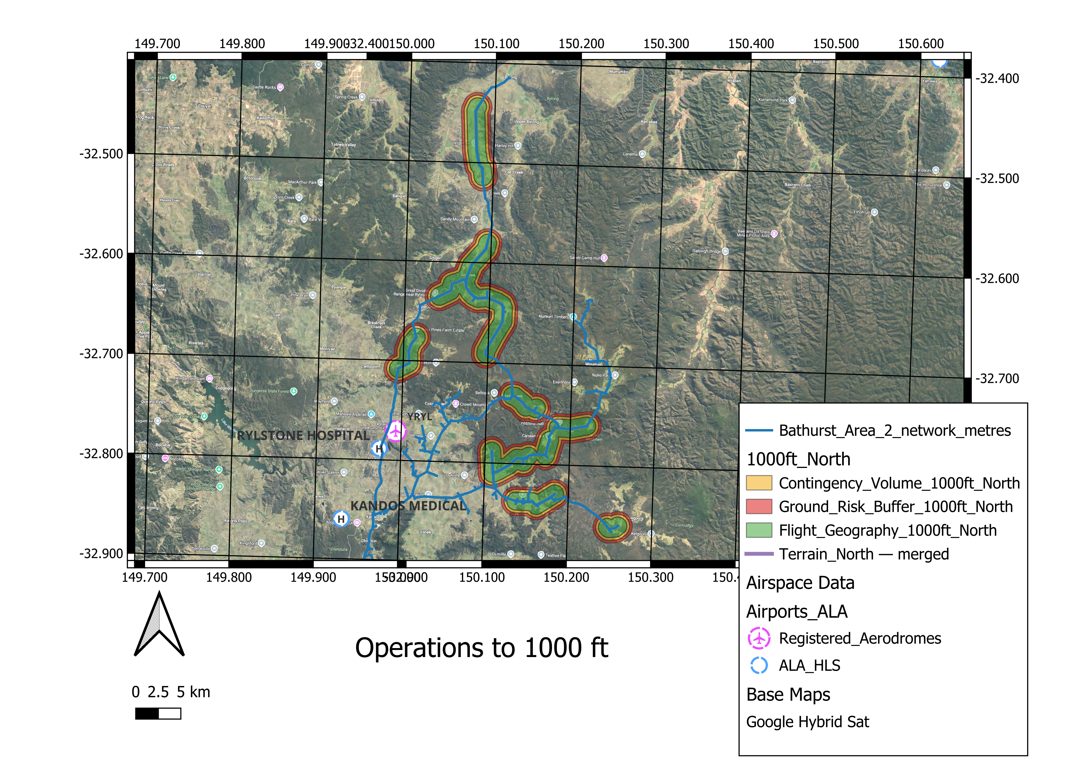
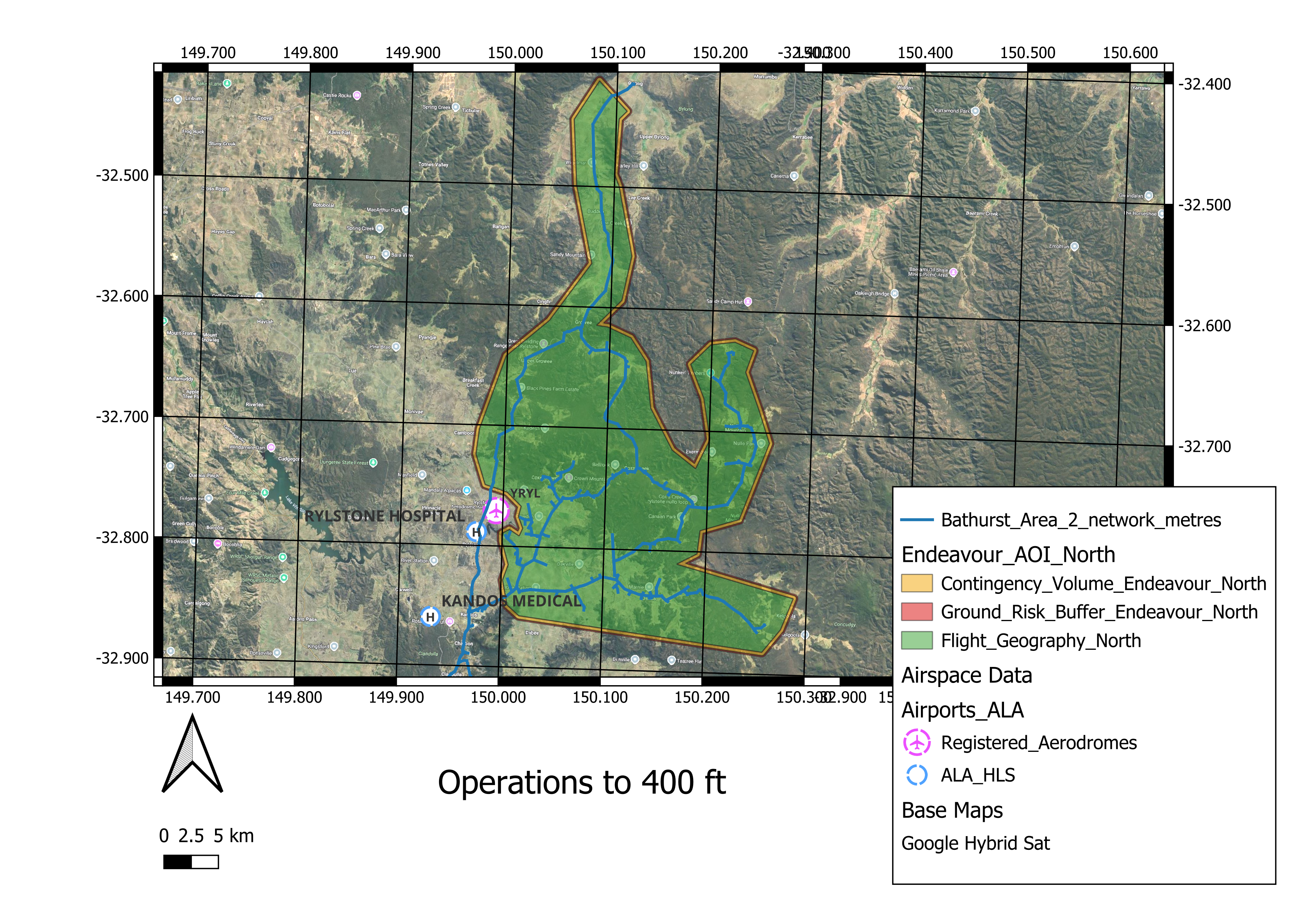
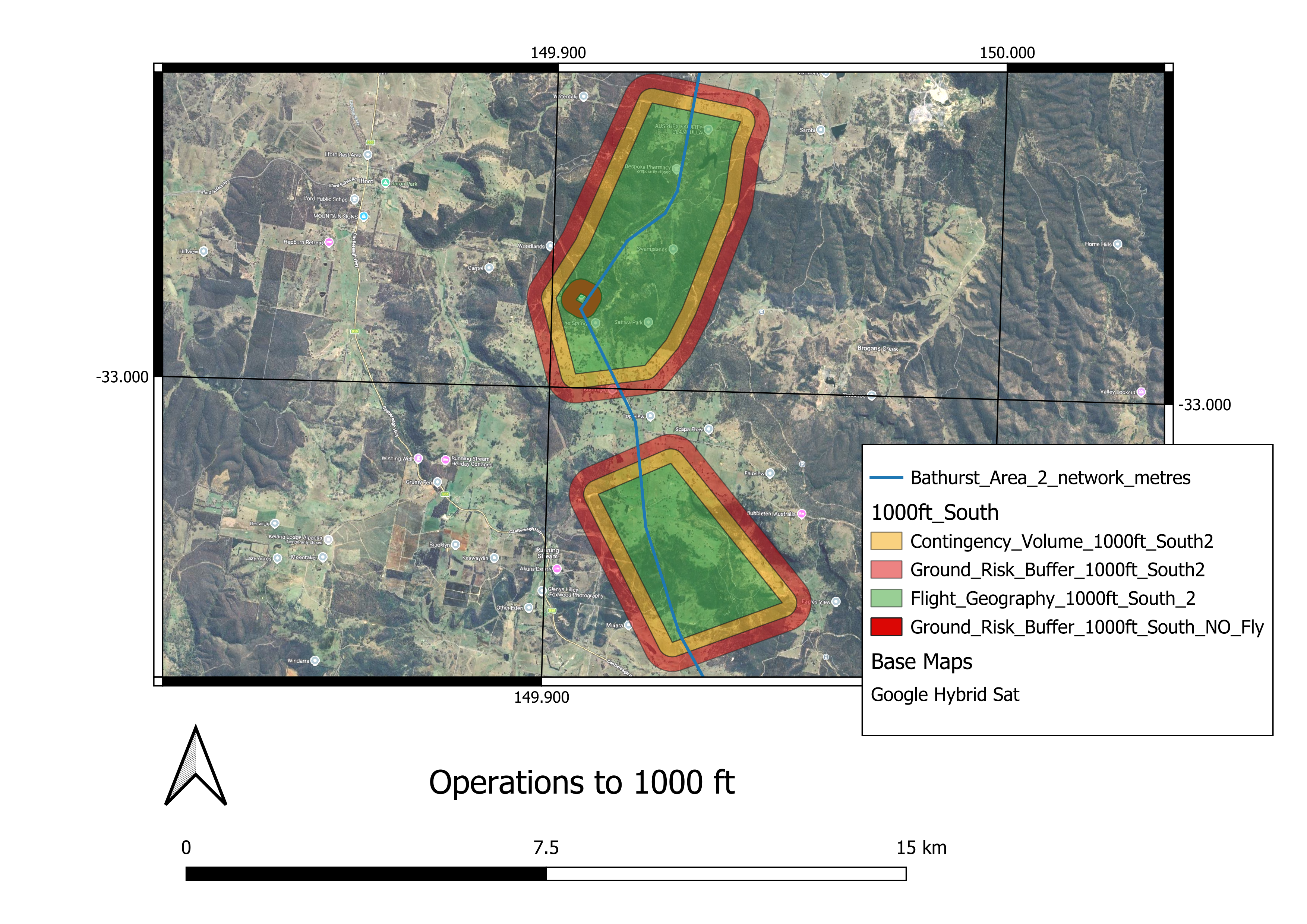
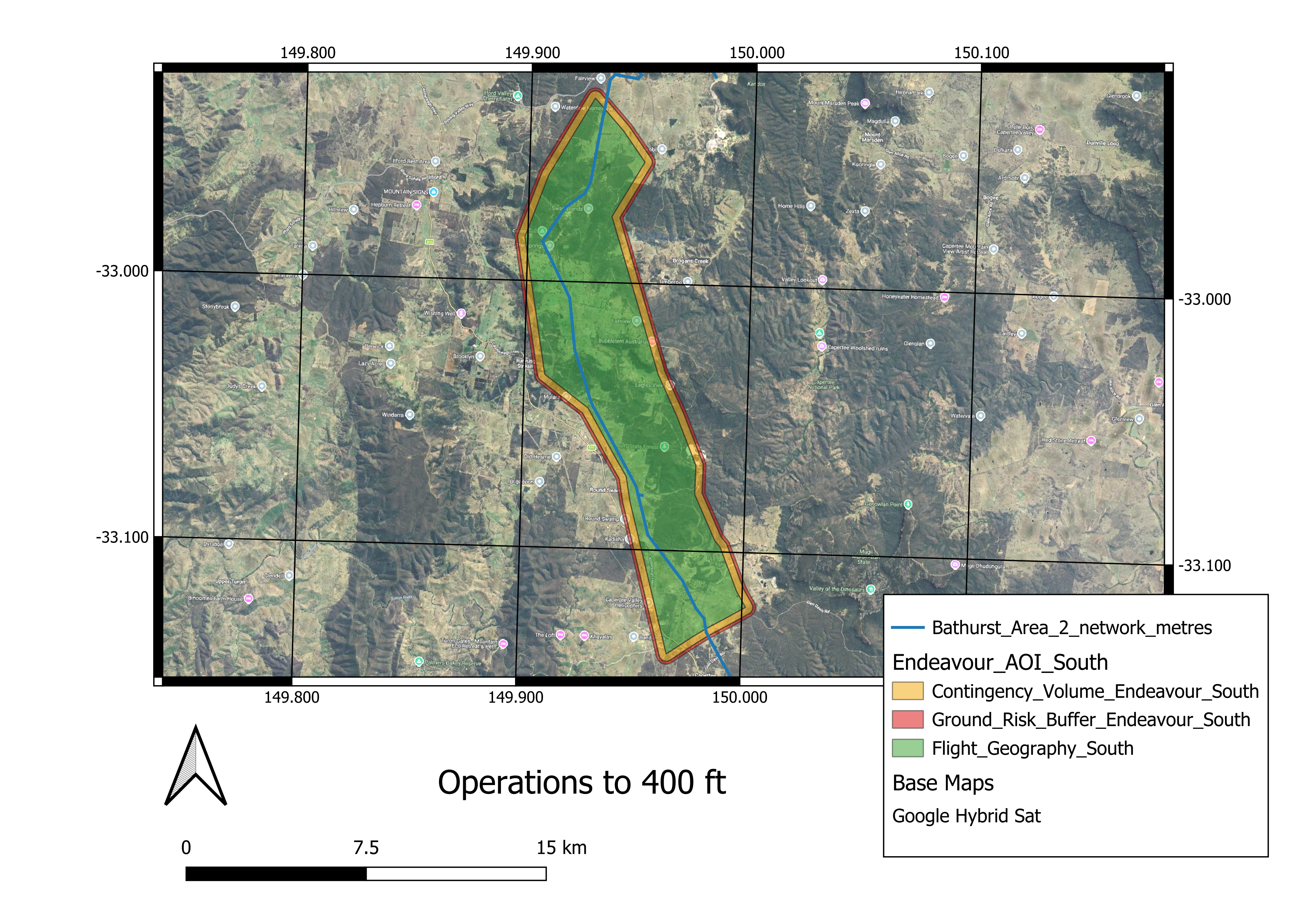
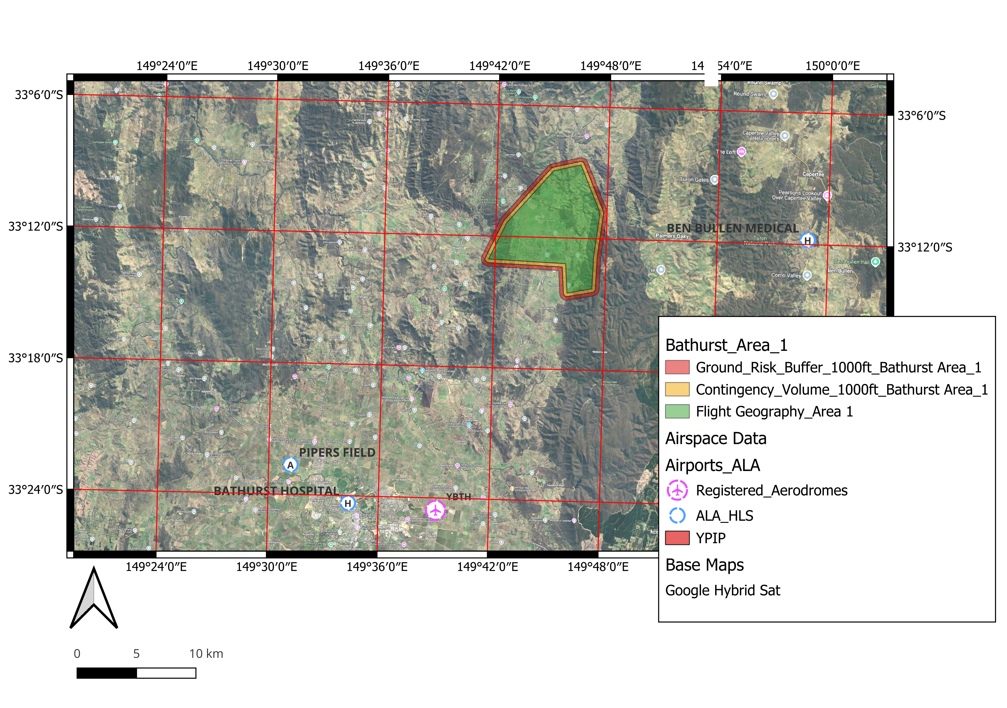
Maximum Operating Altitude: Below 400ft Above Ground Level (AGL) and below 1000ft AGL. Operations will be conducted not above 1000ft AGL.
NOTAMs: A Notice to Airmen (NOTAM) will be published to notify airspace users of the actual dates and times of operation.
Purpose
The purpose of these Beyond Visual Line of Sight (BVLOS) operations is to conduct systematic aerial inspections of power transmission infrastructure using long-endurance Remotely Piloted Aircraft System (RPAS) equipped with advanced sensor payloads.
Proposal
Please see the below maps: